
I will try to write a bit about what has been my last month running, climbing and riding a bike in the American West felt like. I say “try,” because time stretched and compressed—at once two years and a single day. It was intense and overflowing with experiences and landscapes, enough to scramble any sense of duration.
Let me start with its genesis. After linking peaks across the Alps last year and the Pyrenees the year before, I wanted more of that continuous motion in alpine terrain. Western States was my main racing goal, and while planning for it I realized that, despite many trips to the U.S. over the past 15 years and having many friends there, vast regions were still unknown to me: their landscapes and their cultures. A summit link‑up felt like the right way to explore both the country and my own long endurance capacities.
I knew of prior long link‑ups in Colorado and California. In Colorado, linking 14ers fast is tradition, often with car shuttles. My friend Joe Grant had done a self‑supported Colorado 14ers link‑up starting and finishing at his home. In California, Jason Hardrath connected the 14ers by human power with support. Trying to go a bit faster on those routes didn’t attract me. If I was going to do a project there, I wanted to span more landscapes and communities. The Lower 48 have fourteeners in several states—Colorado, California, Washington—with a lot of country between. That scale sounded worth exploring. I also wanted to finally put my feet on routes I’d heard about for years—LA Freeway, Nolan’s 14, the Elks Traverse, Norman’s 13. Including them wouldn’t be the quickest way to link 14ers, but the aesthetic line resonated more than efficiency.
Timing was the first question. Early summer offers long daylight, but Colorado’s thunderstorm risk is higher. Mid‑summer meant desert heat on the bike and, with the kids’ school holidays, we preferred to stay home. September felt like the compromise: shorter light, but more reasonable desert temperatures and usually low precipitation and thunderstorm risk in Colorado and California. The risk was running into late October—winter storms and a late‑season Rainier (glaciers wide open). I told myself that if I made it that far, I’d figure something out. September also worked because Emelie’s mother could be with her and our daughters at home.
Access and land management were the other big concern. Compared to the Alps, where route planning hinges on technical feasibility, the U.S. adds a layer of legality—private land and a constant chorus of “Private Property / No Trespassing” signs. Three Colorado summits are on private land: Lindley (waiver access), Bross (legal to just below the top), and Culebra (closed). I decided to skip Culebra; I wanted the project to be repeatable by others and I believe in public access to natural spaces.
Preparation
Good planning matters, but so does accepting that the plan will change—weather, conditions, and safety dictate constant adaptation. My goal wasn’t to “stick to a line,” but to keep moving all time.
I don’t know the U.S. backcountry like I know the norwegian mountains, the Alps, the Pyrenees, or even Nepal mountains—especially with private‑land constraints—so I prioritized public trails and well‑documented lines like FKTs (fastestknown.com), Strava heatmaps, and from there I build a line / route using Footpath and the COROS app. I checked ideas with Joe Grant, Vitaliy Musiyenko, Andy Anderson among many other local runners, and I’m very thankful for all their beta! For bike legs I leaned on Google Maps and cyclotourism sites to verify where cycling is allowed. Later on, with Preston we did check all routes for private lands, allowed bike freeways, closures by fire or others.
The Team

From Longs Peak trailhead to Longmire at Tahoma / Rainier, the project was human‑powered, on foot or by bike, and supported. The RV was our kitchen, bed, and gear shed; it carried bikes when I was running. The headlines may show one person, but this was a team effort. Without the crew it would have been impossible—and far less fun. My best memories are the jokes and collective “oh no” moments.

Preston from Colorado: logistics lead, cook, team coordinator, problem‑solver, and vibe‑setter.

Nick from Seatle: photographer and frequent summit partner; unflappably cheerful. Still never seen him mad.

Joel from Manressa: videographer from the Pyrenees and Alps projects; humor and calm in equal measure.

David from Sant Llorenç de Morunys : photo and video. From the Pyrenees and Alps. Excellent meals. With Joel, turned the RV into a true American home.
Mireia Miró, longtime friend, now Marketing manager at NNormal joined for the first two weeks on the road. Afterwards she kept coordinating the project from home!
Also, not on site but working from home was all the team at Lymbus and Nnormal making working on the communication and social media and developing the products I used!
Pictures by David and Joel.
Diary
Here some daily Impressions from my notes and images from my phone.
Left Norway on September 1 and landed in Denver that evening. On the 2nd we prepped the RV and gear. Met the Smith brothers, who in 1974—when they were kids—climbed all the contiguous‑U.S. 14ers in 48 days with their dad, driving between peaks. Their stories—and how access has changed—were inspiring. Bike fit, a small Denver event, then sleep in Estes Park.

September 3 — LA Freeway
At 4:30 we drove to Longs Peak TH to meet Kyle Richardson (Longs FKT). We ran up in the dark—me following Kyle’s memory of every step—talking mountains and routes. We topped out at sunrise: sharp sky, a touch of ice on the Cables, and clear air. After photos and a few quiet minutes, we dropped to Pagoda where Kyle turned back.
The ridge rolled on—easy, fun scrambling with big valley views and lakes on both sides. After Isolation Peak it got plainer—grass and talus, little hands‑on—but near Arapaho the interest resumed. I hit its summit at sunrise (magnificent colors and views) and ran to Buckingham campground in the dark, where the team waited. Quick change, food, gravel bike.
Lael Wilcox joined for the ride to Echo Lake—hours of dirt and pavement, talking long efforts, nutrition, strategy, sleep, and fun. I arrived cooked, ate, slept 2.5 hours, and woke with first light.
Run: 16h19 — 59 km — 5,700 m
Bike: 5h11 — 79 km — 1,860 m

September 4 — Blue Sky & the Front Range
From Echo Lake I climbed past Chicago Lakes. Lots of wildlife: moose, elk, mountain goats, a bald eagle, marmots… Over Blue Sky / Evans to Sawtooth in cold wind; the balcony to Bierstadt is spectacular yet easy. Crowds on Bierstadt (one of the most accessible 14ers). Nick and I ran to Guanella Pass. I continued over Square Top and Argentine as weather deteriorated—rain, thunder, graupel near Argentine Pass. There was photographer Andy Cochrane and we bailed to the valley to wait out the worst weather, then tagged Grays and Torreys by sunset. Felt very tired and slow, crap. Not myself. Jet lag, altitude? Coyotes sang in the dark as I finished above Montezuma.
Run: 14h33 — 53 km — 4,000 m

September 5 — Tenmile Range
Five hours’ sleep; heavy rain and cold at start. Bike. Felt a bit “What I’m doing here?” I layered everything: insulated jacket/pants, rain jacket/pants, insulated mitts plus shells. Ken Gordon (from Hardrock) joined in the dark and rain when I hit pavement. We rode to Keystone and up the bike path to Swan Pass. Sunrise brought warmth and energy. Through Breckenridge to Quandary TH, where skimo athlete Sam Wescott joined; Sam, Nick, and I ran to the summit and back – Great trail, beautiful views. Felt ok there. Crowded mountain.
A short ride to Montgomery Reservoir, then up to Lincoln – lots of talus- as snow squalls alternated with sun on Bross, Cameron, and Democrat. The ridge to Buckskin and toward Mosquito was a delight—consistent Class 3 on solid holds with Sawatch views. Beyond, old mining roads and adits crisscrossed the crests—silver and gold heritage etched into the range.
Darkness at Mosquito, then up Sherman, some nice easy ridges there. Preston met me on the summit; we ran to the trailhead, and I pedaled to Leadville – cold! – to sleep.
Run: 13h14 — 45 km — 3,600 m
Bike: 4h29 — 70 km — 1,000 m

September 6 — Holy Cross & first Nolan’s steps
Four hours of sleep; bitter cold predawn ride with Ken toward Holy Cross. Fog in meadows made the plateau feel like a fairytale as the sun rose. Swapped to gravel up Half Moon road—rugged and wrist‑tingling for a non‑biker like me. From Half Moon CG, Nick and Andy joined the run. Holy Cross is beautiful—pyramidal, steep‑walled, but with an easy summit trail. Beautiful views: Elks to the east, Sawatch to the south.
I carefully descended on gravel (forearms fried), met Ken, and rode back toward Evergreen Lakes.
Late afternoon I started the Nolan’s 14 section from there with Gavin McKenzie. Off‑trail up Massive, started to feel empty and slow again. Summit in the darkness and a cluster of white mountain goats on top. We dropped to North Halfmoon Creek, crossed, and—after a valley error with some extra miles—we bushwhacked to the right drainage. Steep, loose, slippery rock under fresh snow made Elbert slow. The clouds parted under a big moon. A long descent led to Twin Lakes, a warm meal, and four hours’ sleep.
Run: 14h30 — 54 km — 4,300 m
Bike: 5h50 — 163 km — 2,000 m

September 7 — Kind of a rest day
A detour to the Elks by bike over Independence Pass. Memories of skiing here with Emelie in December 2015. Met three cyclists (rare across the whole journey). One rider, Simon—Mountain guide, often on Rainier—gave me his number for later beta. Rest in Aspen: food, shower.
I’d been feeling off the first week; Jesus Alvarez/Herms suggested jet lag, altitude, and dry air were likely culprits, and that after a week it might settle things. I decided on an easy day: ride Twin Lakes → Capitol Creek TH and sleep six hours. For once, I reached the RV before dark and could prep calmly.
Bike: 3h52 — 87 km — 1,300 m

September 8 — Elks Traverse
Short ride to the TH, then off with Simi Hamilton (Former XC skier, mountain guide and Elks FKT), plus Nick. Dark start, good conversation, we had many common friends from the XC ski world, and Capitol’s final ridge—airy, clean scrambling—at sunrise. Simi and Nick returned; I dropped a gully to Pierre Lakes, crossed endless boulders, climbed a nasty loose pass, contoured east, and took Snowmass’s east ridge. Down its west side, off‑trail south under the ridge.
At Geneva Lake trail I met Swedish photographer Bjarne Salén, he lives in Crested Butte now, so those are his home mountains; we ran together to a notch on Maroon’s east ridge where he dropped toward Crested Butte. There I met Ryan Hall (2:04 marathoner, doing mountain adventures now). We scrambled South Maroon to North Maroon—red conglomerate pinnacles, solid and fun—then down to Crater Lake to refuel and up Pyramid, with more enjoyable ridge scrambling and herds of mountain goats.
We descended a loose rock NE couloir, then some more bush walking (a lot of that in Colorado!) and climbed Cooper Pass at dusk. Moonrise and starfields framed silhouettes of towers. Up Conundrum on moving rock; I smashed my phone screen on a misstep while checking the route. Ridge to Castle with Ryan, who then ran home to Crested Butte (60 miles day for him!). We’d spent the day talking racing, spirituality, nature, and meaning. Nice to had meet him doing something like that. I ran north to Aspen reflecting on how special it was to share local mountains with people who love them.
Run: 21h23 — 76 km — 6,700 m
Bike: 0h30 — 6 km — 270 m

September 9–10 — Nolan’s (continued)
After three hours’ sleep, I biked back over Independence Pass. Some rain there. At La Plata TH I met Lewis (COROS founder) to climb via Ellingwood Ridge—the normal trail was closed after a recent fire. Thunderstorms forced multiple retreats under boulders and rock roofs, but we eventually topped out. Cold, wind, and dark skies.
I ran down to find Nick at the valley and grab some food, rain heavily, then up Huron as night fell. On that climb I crossed paths with another long‑link‑up runner on hour 30‑something—the only person I’d see for the next 24 hours. Clear skies at altitude returned and a giant moon lit the off‑trail descent: talus to deep forest.
I made a mistake following a south→north FKT track in reverse—leaving the trail toward a steep, sliding talus bowl to Missouri. Great for descending; horrible for climbing in the dark. 2 steps up one down. Eventually I reached Missouri, then Belford – great ridge there! – and Oxford, and finally Harvard with sunrise warmth.
The Nolan’s terrain isn’t technical but it’s mostly off‑trail—bushwhacks and talus make progress slow. I hit Yale, met Nick, and ran down to Avalanche for a 30‑minute nap and a big feed.
Princeton arrived with more storms—graupel and lightning—so I hid briefly below the ridge, then sprinted the crest to escape exposure. Sunset painted the autumn forest in orange. I met Joel in the woods; we ran into Alpine where the team waited. Sage Canaday joined for the final three Nolan’s summits—his home peaks.
Up Antero in a snowstorm and high winds, minimal visibility. The storm intensified over Tabeguache. We reached Shavano on a thin blanket of fresh snow, then descended. Déjà‑vu episodes surfaced (as in the Pyrenees), oddly pleasant companions in the dark. At the trailhead, Preston had our bikes; Sage and I rode together for a while before parting—he home to Salida, me to our rented apartment. It was sunrise.
Run: 38h26 — 108 km — 11,100 m
Bike: 3h59 — 80 km — 1,300 m
No phone – no photo
September 11 — Pikes Peak
Three hours of sleep, big breakfast, then east toward Pikes. A brutal west wind knocked me off the bike; heavy rain followed. I saw a farm and thought to get some cover. Preston saw the storm and was parked not far ahead so I ducked into the RV, dried out, waited the squall, then continued with more showers. Another strong storm at the TH prompted a few minutes nap while it cleared.
Night ascent with Chris Myers and Hans Troyer (fresh off Western States 2nd and 8th), plus Nick. Nice trail, great after all the slow off-trail from Noilan’s. Felt pretty ok considering the last almost non stop 72 hours. Wind hammered the upper mountain; the summit is a parking lot with a building—probably prettier by night, with Colorado Springs and Denver glowing to the east. Fun to run with those young talented athletes, talk about western and utmb a ton, the state of trail and professionalization, training etc. Felt sleepy on the way down.
Back to the TH and a solid six hours’ sleep. After a rough first week, my body finally felt like it was adapting—tired, yes, but recovering fast on minimal sleep.
Run: 3h45 — 22.6 km — 1,340 m
Bike: 7h00 — 161 km — 2,100 m
No phone – no photo
September 12 — Toward the Sangre de Cristo
The ride was gorgeous: the western‑movie main street of Cripple Creek; then a dirt‑road canyon of red walls and crags – great to climb! Past Carson City came long dirt climbs through canyons and high ranch plateaus—buffalo, horses, cows.
A severe storm hit as I entered San Isabel National Forest. I waited in the RV and, watching the forecast, decided to start the Crestones Traverse at night as storms faded. Wind and snowfall already at South Colony Lakes and lots on Humboldt convinced me to retreat in the dark and return at first light when see where to go.
Mireia got me a new phone.
Run: 6h23 — 27 km — 2,000 m
Bike: 7h32 — 151 km — 1,350 m
No phone – no photo
September 13 — Crestones
At dawn I repeated the approach in fog and drizzle. On Crestone Needle’s ridge the rain ceased but visibility stayed tight. Wet new snow made the down‑climb to Crestone Peak interesting—good conglomerate (Montserrat‑like), spikes on shoes, careful route‑finding. A long, steep snow‑and‑ice couloir led down; I traversed a balcony into the bowl as clouds broke to reveal autumn colors.
Sun arrived near Columbia Point, opening the full view of the Crestones—black‑and‑white needles over desert and distant sand dunes 3,000 m below: stark contrast, and perhaps my favorite range so far (tied with the Elks). I met a couple on the snowy ridge, then crossed to Kit Carson and down a face that—once at Challenger—proved to be the “wrong” side (easy ramp on the other). The views were tremendous.
I changed to bike gear at the TH, only to be hammered immediately by a thunder and graupel storm—hail stinging head and limbs, lightning close, the road a river. I sprinted to Crestone and hid in a supermarket while the team caught up with the RV. Clothes change, then a beautiful night ride: two ruler‑straight stretches (20 km east, then 50 km south), smooth pavement, distant lightning shows, and the feeling of flying in the dark.
Run: 10h36 — 30.5 km — 2,750 m
Bike: 2h34 — 75 km — 170 m

September 14 — Blanca Group
Quick bike to Zapata Falls, then up Zapata Creek—lakes, rivers, and clean granite. On Ellingwood Point’s saddle I met a group under clear skies as the sun melted recent snow. Ellingwood’s name appears everywhere—Sage later told me he was an early‑1900s Colorado pioneer climber. South and west faces were dry; north and east held snow. Easy, excellent scrambling on black granite. The Sangre are definitively my favorite range in Colorado.
I traversed to Blanca, then a spur down to a lake in the east to reach private‑land Lindley via its waiver trail—some hikers there and fine ridge scrambling to the top. Beautiful summit. Extensive wild nature around, private properties, which is a bit weird.
Back over Blanca, I felt light and strong. Back fully myself. The long ridge to Little Bear is superb: firm, narrow, mostly easy but exposed—a route I’d repeat every other day if I lived there.
Run: 10h40 — 37 km — 3,600 m
Bike: 3h26 — 74 km — 500 m

September 15 — San Luis
Headwinds from Alamosa to Creede previewed the desert ride. Creede itself felt time‑stopped: a half‑naked cowboy dancing in the sun as I ate bakery pastries; mining scars still shaping the village and near canyons.
Nick and I ran San Luis and then I followed the Continental divide Trail to Spring Creek Pass. Sunset over the San Juans was painterly—trying to name silhouettes: Sneffels to the right? Echo peaks to the left? I grabbed the bike to Lake City and up to Nellie CG.
Run: 6h22 — 44 km — 2,160 m
Bike: 7h00 — 145 km — 1,600 m

September 16 — Eastern San Juans
Uncompahgre and Wetterhorn were new to me despite five Hardrocks, How is it that I’haven’t been here before?!—both easy routes with an airy last bit on Wetterhorn and huge views. Between them, a big sheep herd and a summering shepherd’s tent and horses.
Plan A was Lee Smelter Gulch to Redcloud’s east ridge ( had read one report from Bill Briggs doing that when he linked the 5 14ers of Lake city) but “No Trespassing” signs and bushwhack hell turned me around. I biked the long way to Mill Creek west of Sunshine. Lake City is a proper mountain town, and the (new) lake is beautiful. Cataract Gulch valley is paradise.
I climbed Sunshine via a steep trail/off‑trail line traversed to Redcloud (very red rock, very rocky—names don’t lie), then met Nick and Bryon Powell at Grizzly Gulch ( Hardrock aid station). Together we ran Handies on familiar ground; felt great actually and could push the last bit to the summit to arrive before sunset. Anna Frost and Meghan Hicks greeted us on the summit with brownies while we enjoyed sunset. Despite our collective Hardrock laps, we still briefly lost the trail while chatting, been knowing these folks for over 15 years so we had lots to catch up!
At Animas Forks I met Preston and Scott Simmons (first met at my first Hardrock when he was cheering in the mountains with his son Quinn), grabbed the gravel bike, and—despite Scott’s doubts—rattled down Engineer Pass road in the dark. With his MTB lead I survived; wrists and forearms thrashed, but I almost enjoyed it.
Run: 11h30 — 59 km — 4,800 m
Bike: 5h05 — 63 km — 950 m

September 17 — Sneffels & Wilsons
I finally got to pedal the Ouray→Governor Basin road I’d always wanted during Hardrock (Running that road sucks). Scott joined; we admired every -still dry- ice climbing line in the canyon. At Sneffels TH we met Dakota Jones and Nick and took the SW ridge—much better and enjoyable than the standard. Went down normal and then I ran HR100 course trails toward Telluride and soaked in Kroger’s Canteen memories. Very hot at Telluride.
Bike over Lizard Head to meet Dakota and Nick; long wild approach to Wilson Peak through deep forests and old mining roads. Nick turned before the ridge; Dakota and I continued into icy, windy conditions to Wilson peak. Another nice sunset from there – never gets old to have beautiful sunsets from summits. Down between Wilson peak and Mount Wilson we found lots of old mine remaining, even an iron wagon! crazy up here! The ridge between Mount Wilson and El Diente. I thought the route was to stay a bit on the east side. It was some snow that made the slopes seem a bit steeper and the rock there was pretty bad. Luckily Dakota told me he didn’t feel very comfortable there and we turned around to go down normal route and up El Diente, but when we reached the ridge again, we saw that following the ridge right on top or contouring west side was actually the route. Ridge was fun. It’s never difficult but it had a couple of downclimbs that were nice. To be climbing at night is special. We change from admiring the landscapes to admire the shapes the rock forms in the space of our headlamp. From macro to micro.
Night made the rocky trail off El Diente slow; also the already long day. I counted down tenths of kilometers 3.3, 3.2, 3.1, 3, 2.9… to a warm meal and a bed to sleep in. At Kilpacker TH our RV was missing. We did a couple of tours around but nothing. Where were they? We were pretty cold so we decided to continue running in the path I was supposed to bike the next day. I sent a message via inreach. We didn’t knew if they had some problem with the RV, if the route was closed or if they were waiting somewhere else, and then where. Eventually we could get in contact and it was an unfortunate misunderstanding. When I started planning the project I remembered that in 2015, when we were skiing in Colorado with Emelie, we did Mt. Wilson from Cross mountain via a couloir in the southeast, and drew a line there. After I saw that that route was not really smooth in summer and drew another line on the trail to Kilpacker, but somehow I left that first line on the map and the team was waiting for us there. Well, it was not fun to run an extra 15k on the road after a long day but you know: more kilometers, more fun. A great anecdote to laugh about in the future.
Run: 14h25 — 63 km — 4,200 m
Bike: 3h10 — 38 km — 1,500 m

September 18 — Chicago Basin
Post‑Engineer‑Pass confidence pushed me onto the East Fork trail from Cross Mountain to Purgatory—lots of on/off the bike in the climb. Then playful singletrack with sunrise fog and elks in meadows. Lots of hunters there too.
At Purgatory: Dakota, Braz, friends, and Preston. The approach to Chicago Basin is long: 7km down to the river, 10 km on the rails, 10 more up the flattish valley. With Dakota and Nick went to Eolus, met Joe Grant at Twin Lakes (he’d run in from his home! We didn’t talk long since he needed to run back but so great to see him there), We went to North Eolus and Eolus—red granite, easy but aerial ridges. Dakota and I continued to Sunlight (narrow needle summit) for another perfect summit sunrise (How many already in a row?) then Windom in dusk. I bonked hard on the last uphill and ate my last sandwich.
On the way out I nodded off while running. A runner—friend of a friend, was too sleepy to remember his name—came in the railway and when we crossed the river handed me a bar that lit the fuse for the final climb to Purgatory, where Preston had rented an apartment. Shower number three of the trip (after Salida and Ouray, one more to go at Bishop). Some good risotto (David was cooking great rice meals every Thursday) And good sleep. Colorado complete.
Run: 13h21 — 65 km — 3,500 m
Bike: 4h05 — 41 km — 1,000 m

Sept 19–23 — Desert Ride: Colorado → California
Sept 19 —
Up after 4.5 hours for a cold, clear start. Chris Myers joined out of Purgatory; soon Scott Simmons, sons Quinn (Lidl–Trek) and Colby (EF), and friends joined too. Classic bike coffee stop in Durango; Great to see how the sons had evolved from skimo promises to great pro riders, we chat about training, nutrition, racing… After the coffee stop, we continued with Chris and Scott south of Mesa Verde. We took gravel roads at Prayer Canyon—red walls, towers like Chimney Rock, we saw some ancient cave paintings. Scott rode a road bike and floated the rough 60 km gravel with ease.
Felt good but kept reminding myself: this is day one of many. At Teec Nos Pos, Scott and Chris shuttled home and Gemma Arró (friend from Cerdanya; teaching in Utah) joined. We rode to Kayenta and slept.
Bike: 10h58 — 305 km — 2,000 m

Sept 20 —
With Gemma to Tuba City, talking Norway/US and education. I continued to Flagstaff; Route 66 alternated freeway, side dirt, degrading to off‑trail and fence hops before Williams. Slept there. Some rain.
Bike: 12h17 — 284 km — 2,200 m
Sept 21 —
All day on Route 66: desert, flat, headwind, villages every 50–60 km; that emptiness is its beauty. Strong winds made 20 km/h feel like a sprint on flats. Mohave country; Peach Springs had a celebration. Route 66 nostalgia everywhere—souvenirs, vintage signs, old cars. Less traffic; mostly motorcycle groups. Rough pavement, some dirt. A welcome mountain pass after Kingman—Sitgreaves—glowing sunset colors in canyons. Slept near Needles by the railway; police checked on RV after recent train robberies. They said there were there waiting for a friend on bike. I was arriving, probably poice thought it was a bachelor party, they just left they friend with a bike on the desert… When I arrived police was gone.
Bike: 13h39 — 320 km — 1,800 m
Sept 22 —
Mohave again, between Piute Mountains and Old Woman Mountains Wilderness. Many roads closed to vehicles but bike‑passable; dried creek washouts required foot crossings. After Barstow I took a sandy desert track and slept there—beautiful desert night. Not much going on. Only distraction was was counting the number of wagons the trains had, some were 2 kilometers long! With hundreds of wagons. They were passing often.
I tried to call home as much as I could, a month is a very long time away from kids. The time change didn’t help much as when I was going to sleep they were waking up and when I was waking they were asleep. For them, I was just doing what I do every day – and since most of our friends do activities in mountains, what adults do – but in another place of the world. I could share with them some images of the desert, the animals I saw, the volcanoes…when I was passing by.
Bike: 12h35 — 272 km — 1,400 m

Sept 23 —
Within minutes of starting, Preston was excavating the RV from sand—our only water crossing in days undermined the track and sank the rig. Towing call placed; I pedaled on barefoot for a while to dry sand‑soaked feet before shoes. My narrow bike shoes were torturing swollen little toes after all the running; I ordered wide ones to meet me in Bishop for the Washington leg.
I finally turned north after days due west; mountains rose on both sides. Reached dry Owens Lake at dusk and climbed in the dark toward Cottonwood Lakes. After desert days at 39°C, the temperature plunge with altitude felt great. I was happy to be off the bike for a while and back on foot.
Bike: 12h26 — 235 km — 3,300 m

Sept 24–27 — Norman’s 13
Norman’s 13 is Andy Gohlich’s continuous link of the Sierra 14ers. This was the part I most anticipated: the High Sierra’s reputation for superb granite, technical ridges, and remoteness. After weeks of mostly walking terrain, I was eager for more hands‑on climbing.
At first light, Rod Farvard and Matt Zupan (unsupported FKT ) joined; Nick too. The forest is cathedral‑like—huge pines cloaked in green lichen above sandy flats, lakes tucked into granite basins. Mt Langley came via easy trail with wide views; Matt turned back, and Rod, Nick, and I continued.
Trail vanished into talus as we moved valley to valley toward Whitney. Nick climbed to the summit while Rod and I looped over Mt Muir, named for John Muir, father of preservationism. He believed nature had intrinsic value and should be protected for its beauty, spiritual significance, and ecological importance. He is considered the seed of the national parks in the US. His influence has granted that today we are able to enjoy these huge wild areas and contemplate an almost untouched nature, but most importantly, that the biodiversity and ecosystems of this unique areas is preserved from human exploitation and can develop fully.
On Whitney we mingled with a father–son duo, friends ending a technical climb, older Indigenous hikers—summit is an excuse where many different people find happiness in different form.
Nick went back and with Rod we dropped the slabs and Mountaineers Route—some ice and snow, manageable—then crossed to Mt Russell to meet Dan Patitucci and Kimberly Strom. Dan and I have nearly intersected for years in Himalayas and Alps, so meeting on his home granite felt right. I was wondering where the name came from. There is a Russell summit in the Pyrenees, named after Henri Russell, one of the most active explorers of the Pyrenees in the 1800’s…but apparently the Californian one is named after another Russell, geologist and geographer.
From there I continued alone, north as another Sierra sunset painted the skyline. Light rain and wind hit Williamson; distant storms flashed. I followed GPX in the dark to Tyndall, down Shepherd Pass to the JMT. After Forester Pass – many coyotes – fatigue hit; I bivvied an hour when i hit the forest. I’ve been out for about 24h.
Energized by daylight and a sandwich, I ran down the valley and met with Andy (photographer) we ran up Glen Pass and down Rae Lakes: are unreal—shapes, islands, forests, animals, and granite needles—like a painting. I met many hikers ( prople doing JMT, Rae Loop, PCT) en route to Pinchot Pass (long!).
During this time I was in contact with the team via satellite messages. My original plan it was to stay for long time on the ridges in the next section, but some weather was coming in the next night and Olivia Amber and Matt Cornell, who would join me for this next section advised me to better stay on the shorter path, so we decided to go for the classical Norman’s route instead of longer ridgelines. Good call seeing the conditions on the night and next day. Under Taboose Pass I refueled with Preston and Nick and grabbed a 40‑minute rest. Olivia and I went up Split in worsening weather: snow and strong wind; 15 cm accumulated by our descent. We jogged Mather Pass on the JMT to Upper Palisade Lake to meet Matt—one of the most exciting alpinists of the moment (fast Alaska ascents, futuristic Jannu North Face).
Wet feet and a rock‑smashed left foot nagged. Olivia continued on the JMT toward Bishop Pass while Matt and I climbed Middle Palisade: long talus, then an unstable gully with bits of climbing. The west side was surprisingly dry; the east was plastered in ice and snow. Careful downclimb to avoid rockfall on ourselves.
We traversed under the Palisade Crest to Mt Sill, talking mentors, style, places to climb… and then I got very sleepy at dusk. Closing eyes for seconds while walking is not ideal; sunrise flipped the hormonal switch and I felt fine again. Fog cloaked the ridge to Polemonium; snow and ice made the climbing delicate—never hard, but exposed. The cluster—Polemonium, North Pal, Starlight, Thunderbolt—sits close, separated by deep notches. Granite was mostly excellent; we used a rope twice (chimney on North Pal, raps off the summit boulders on Starlight and Thunderbolt). As the fog lifted the place became a climber’s tivoli—so many ridges and needles to play on. A must‑return zone.
After Thunderbolt, fatigue came fast—over 50 hours with 1h30 sleep will do that. Wet, sore feet and a long way to Bishop Pass and South Lake remained. After 56 hours I reached South Lake; the team and Olivia (who’d run a long loop) were there. Food, dry clothes, and then a short bike ride down to Bishop for pizza and a long sleep.
Run: 56h11 — 164 km — 11,700 m
Bike: 1h00 — 37 km

Sept 27 — White Mountain
I hadn’t researched White Mountain much—just saw a “trail” in the map from the Bishop side. There isn’t one.
I rode Bishop → White Mountain Ranch road in heat; wide bike shoes felt amazing on my feet. We parked roadside. I took only a wind jacket, half a liter of water, no food, nor headlamp, assuming 25 km on “trail” and ~3,000 m up would be straightforward.
Instead: no any signs of a trail, desert, then unstable scree, then ridge‑couloirs through scruffy forest. I was feeling great, it felt like I had not done anything out of my normal training the day before, so I wasn’t so worried but I didn’t want to get lost in the dark at this mountain. I reached the upper ridges, and there the weather was pretty different. It was raining and snowing a little and the wind was picking. Lucky feeling good means that one can push and keep an elevated body temperature so I continued at a good pace to the summit, The summit itself is anticlimactic—dirt road from the other side, small building (like Pikes or Blue Sky). A couple hikers, a worker fixing the building antena, and Joel were there. Too cold to linger; I jogged down, reentering desert heat.
Jason Hardrath joined the team—holder of Norman’s 13 and California 14ers records—to ride some of the next leg. We pedaled into night talking how passions evolve (his: triathlon → speed flying), his work as a rural Oregon teacher, and the impact teachers have. We slept near Trafton Mountain.
Run: 7h28 — 25 km — 3,000 m
Bike: 4h10 — 87 km — 1,100 m

Sept 28–29 — Ride to Shasta
With Jason, a stop at the famous Mobil gas station/deli (Yosemite climber classic), hot chocolate and a bagel, then north. We crossed runners in the Mammoth 200 (Tim Tollefson’s race). Mono Lake shimmered green‑desert; Inyo NF’s big trees rolled by. Fun climbs; I was faster uphill, Jason flew on descents and flats. After 100 miles he turned home (school day next), and I continued through growing towns to Reno (casinos everywhere). We camped back in the desert.
Bike: 11h25 — 322 km — 3,100 m
I started riding in the desert, the odors of the last days had been the strong and sharp smell of dry herbs, like thymus, and the day was transitioning towards more wet and green landscapes, with the smell of the wood after the rain and the mushrooms growing in the wet soil. Rain strengthened, and at night it sheeted so hard I could barely see two meters. Soaked through, I rode by the map on the head unit and stopped at Shasta’s base, unsure about muddy road conditions higher up.
Bike: 10h38 — 286 km — 2,100 m

September 30 — Shasta
Light rain at start; forecast promised clearer above. The forest climb was gorgeous—bright green lichen on every trunk, volcanic dark soil underfoot. At ~2,500m snow began; wind ramped; Temperature feeling was –20°C with wind chill. I layered insulated pants, jacket, and gloves. Above that, the wind was savage. On eastward traverses I had to brake like skiing downhill; westward I adopted aero ski positions. Nick turned back; On the last 1000 feet elevation I needed to advance crawling to avoid being blown off.
On the final feature I stayed on the east side; volcanic rock was friable and iced, making the last bit delicate. I crawled the last meters to the summit. With that wind the sky was crystal, and northern volcanoes poked above a cloud ocean. Fast descent back into the forest and rain.
At the TH I met Ian Murray (triathlete/coach). We rode some of the most perfect dirt roads I’ve seen—soft texture, forest scents, playful contours around the volcano. Rain stopped when we reached US‑97 and delivered tailwind north; the first clear view of a white Shasta floating above forests was stunning. Night fell and the desert returned; we slept soon after.
Run: 5h27 — 22 km — 2,500 m
Bike: 5h52 — 114 km — 2,000 m

Oct 1–2 — Ride to Tahoma / Rainier
Tailwind joy at last after California’s headwinds. Ian rode to Bend; Klamath Falls and Crater Lake NF slipped by—big lakes, forests, marshy fields; the air was less dry and easier to breathe. Feeling strong, Nice Smith Rock canyon, great climbing spot. Toggled desert/forest all day. We stopped at Shaniko after my longest ride ever—nearly 400 km.
Bike: 12h50 — 390 km — 1,900 m
Next day the tailwind continued through a beautiful canyon to Lake Celilo (Oregon–Washington border and the project’s low point at 52 m). After Goldendale, I left the main road for small routes into full temperate rainforest—starting to feel like home.
Rain returned around Mount Adams on very nice dirt roads. Sunset through wet trees in the Goat Range was spectacular. It got cold on the long, dark descent to Packwood; I used zip‑locks between socks and shoes as vapor barriers. Elk roamed the streets.
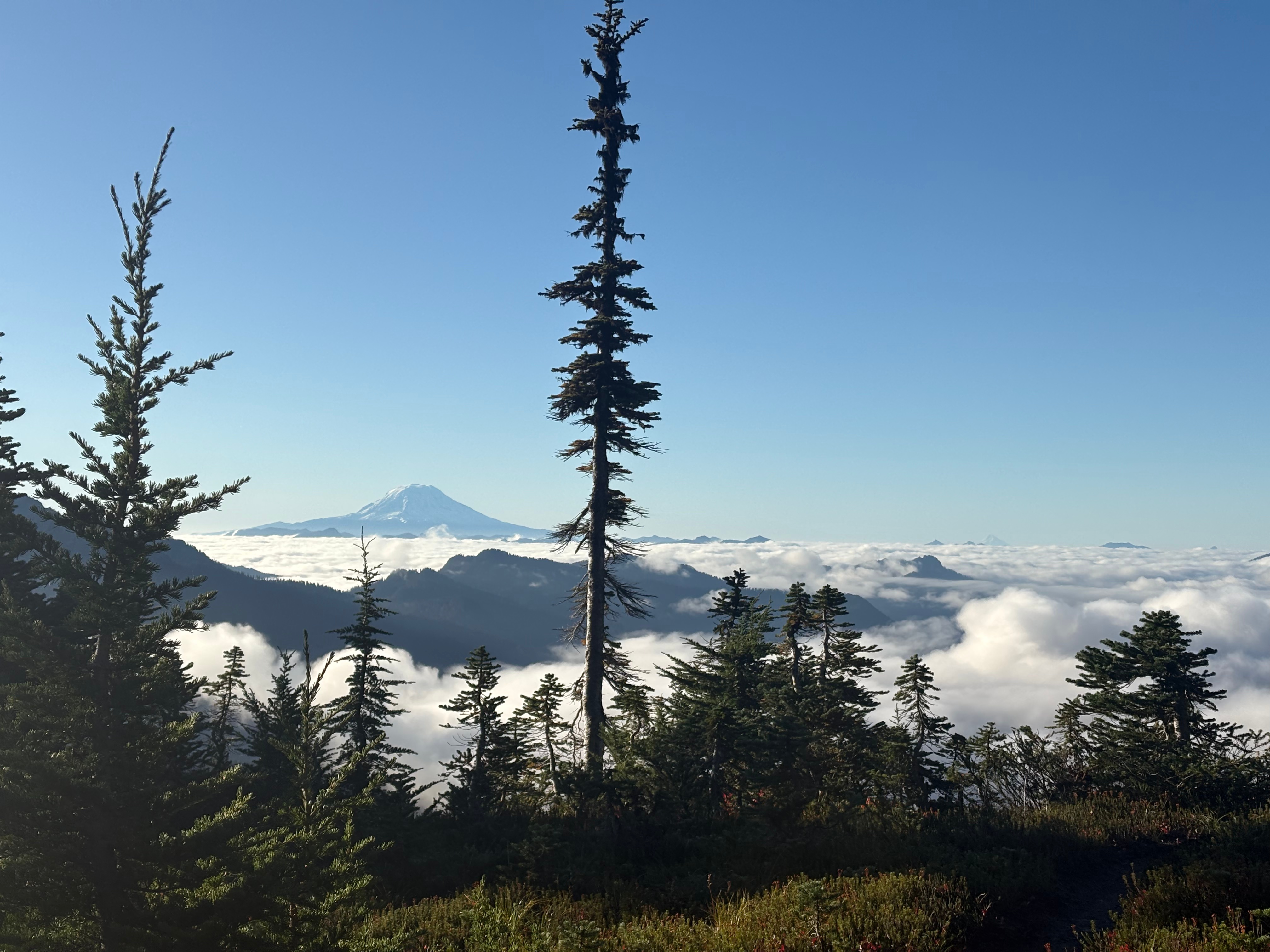
We’d been talking with Rainier guides (Simon from Independence Pass) and rangers. Late‑season glaciers were in poor, open condition, so the recommendation was Success Cleaver—a long, more technical but mostly non‑glaciated route—safer for a solo late‑season ascent. Also, on Oct 1 the U.S. federal government began a shutdown; National Parks had no services. Tahoma remained accessible without permits but with no rescue ops. We worried briefly about closures, but the mountain stayed open.
I rode to Longmire under a near‑full moon—the project had spanned a lunar cycle—and saw Tahoma shining white. Beautiful.

Bike: 13h53 — 302 km — 3,800 m
October 3 — Tahoma / Rainier
We started in the dark on the Wonderland Trail—lush rainforest, glacier creeks, Cascade views, abundant wildlife. Nick was more enthusiastic, showing his love for his mountain and trails. He hared stories from years around Wonderland and Tahoma; we reflected on the month.
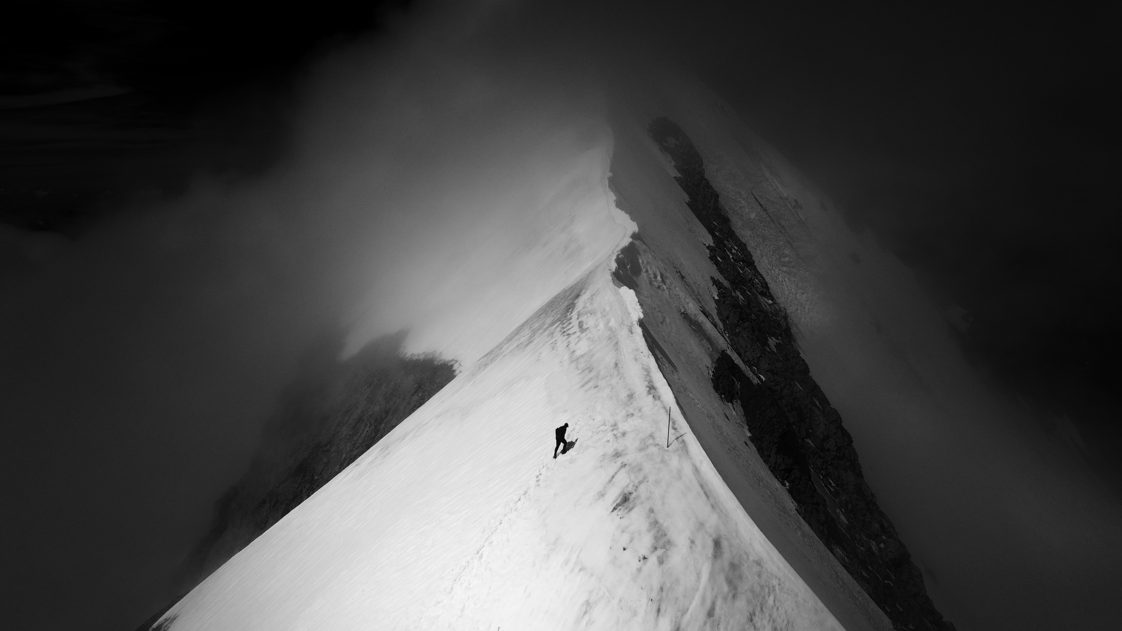
At Indian Henry’s Patrol Cabin we met Joel, still buzzing after seeing a bear in the meadows. We left the Wonderland for Mirror Lakes and, at dawn, our first full view of Tahoma—broad, beautiful, laced with giant glaciers and long ridges. Early snow started low ~2,000 m, meaning about 2,300 m of trail‑breaking. The Success Cleaver involves mostly rock—never very difficult—upper sections low 5 class. with all the new snow I worried about melting and wet‑slide hazard.
Snow firm at first, then deeper; under it, inconsistent talus swallowed legs. We followed mountain goat tracks – they know mountain better -; later, bear tracks crossed ours. At ~2,400 m the ridge narrowed and steepened. Nick turned back; I put on crampons and continued alone. Soon I was swimming in knee‑to‑waist‑deep snow, making only ~200 m vertical per hour. It became clear the mountain might refuse me today. I was climbing at 200m per hour, just swimming in the snow, and with those conditions it would be not very safe to spend a full night on that terrain. It would be kind of poetic to finish the project with the last mountain denying me her summit. But somehow I thought that I would continue until 16h in the afternoon, where I would have a couple of hours with daylight to downclimb the most technical section. I would see where I could make it til that hour.
Thirsty. Knowing that there would be plenty of rivers on the way I didn’t fill my soft flask and didn’t drink anything for breakfast. It had been already more than 14h since I last drank any water at dinner. I found some icicles hanging from one of the rock walls. They were in the sun and melting so I filled half of my softflask with the water dripping. It felt good to drink.
I evaluated descent options continuously—adjacent couloirs and micro‑glaciers might be safer than downclimbing the most technical ridge rock (volcanic, poor anchors) under new snow. At 14:30 I reached Success Point—the top of the ridge at the crater edge—with feet going painfully cold from hours of wallowing. I threaded between crevasses to the summit’s sandy rim. Steam vented from the crater; a cloud sea covered everything; only Adams, Hood, and St. Helens rose above. It was stunning.
No lingering: I reversed into deep snow with the light warming to orange. I raced the dusk to clear the crux before dark—down couloirs was much faster, giant plunging steps in bottomless facets. By the time the sun vanished I was where Nick had turned, and I relaxed, jogging toward the Wonderland while replaying the month’s highlights.
Near the trail, Nick and Preston met me with dry socks and shoes and food. We ran the last seven miles to Longmire together. In the RV with Joel, David, and Laura (NNormal’s PR, newly arrived), we ate pizza, drank pickle juice, and laughed about everything we’d done.

Nutrition
The demands of such a journey are high, around 8500-9000 calories are spent per day. I maintained my weight during all the trip. Sometimes in a long mountain push like the Norman’s where I didn’t eat as much as I spent I could lose 2kg but those were easily recovered in the next 2 days while biking.
Nutrition is key to ensure not only to keep energy levels but also to maintain all the functions and limit inflammation. Therefore the fueling strategy was very different than during a race when I will try to eat very often. Here I was eating only a few times per day, leaving at least 4-5h in between meals, so the inflammation could come down. Also to maintain my circadian rhythms. For that I was trying to keep a regular meal shedule (Breakfast – some food at the mountains every 4-5h and dinner when I arrived at the RV before sleeping) Also I didn’t took any caffeine or stimulant during the challenge (besides a coffee ride at Durango and a coffee at Salida) to not disturb the circadian rhythms and just fight a bit when I was feeling sleepy at the last part of the nights and let the sun to bring me the energy from the hormonal response.
My standard meals would be something like this:
Breakfast: Yogurt with berries and honey or maple syrup. 1 sachet of Lyvecap elite probiotic 800 billion CFUs. Then if I was going to do a long day without food or if my weight in the morning was low I would complement with some more food (bread, nuts cream, cheese, eggs)
During the activity: Sandwiches (hummus, avocado, cheese, salad, paprika…) or chocolate/nuts cream. Nuts, chocolate, flasks with dense smoothie, whatever I could find on shops on the way during bike rides… I could add some olive or coconut oil on the water to add some calories.
Dinner: potatoes, beetroots, sweat potatoes, rice or pasta with some veggies. Broth, eggs, tofu, ginger, oregano, bread (we even found some sourdough ones!), pizza…
I supplemented with vitamins D, C, Omega 3, Turmeric at the evening. And Apple cider vinegar before meals for digestion.
For hydration I was mostly drinking when I was at the RV (from dinner, breakfast and stops during the bike rides) I was drinking water, coconut water or Kombutcha the most. During the runs I didn’t drank a lot, mostly because there’s no much water in the mountains. I would start with 1 or 2 softflasks and refill when I found some water. That means that some days I could drink 5-6 liters in total and some days I would only take 1 L in 24h.
Despite the low water intake, my hydration levels were good. I was checking daily my osmosity and pH ( Using a mx3 device) and I didn’t get extremely dehydrated even on days with very low intake.
It was interesting to see that my sweat rate really changed pre and during the project. During the training for Western states, I did get used to drinking big amounts of water to be able to cool down my temperature, my sweat rate (at 40º in my gym) was of 1,2L/h. During the project, with low water availability my body adapted (decreased sweat, ADH hormonal response to maintain homeostasis with low hydration) and my sweat rate changed to under half litter / hour in the same conditions.

The route
I ran 1012km in 285h and rode my bike for 4133km in 203h.
The elevation gain was of 123.045m.
From Longs TH to Longmire it took me 489h of activity in 31 days. (30 days 19h51′)
The Colorado 14ers (except Culebra) 16 days (15 days and 20h 30’)
The California ones in 6 days and 6h 49’
Here the route: https://www.strava.com/activities/16052740061 you can check at my Strava profile to see all the bike and run activities.
Adaptations
The most interesting thing of the project from a physiological point was to see a net change on adaptation process. During the first week my feeling was bad, and that was corroborated with the data I was taking. My body was “fighting” the enormous stimuli from altitude, jet lag (change of circadian rhythms), dry air and big load. Despite the bad sensations every day and data showing a bad pattern I continued providing the same stimuli. At day 5 I did a shorter stage and I started to see a change. It felt that my body stated to fight those stimuli (creating inflammation and sending alarms to the central governor to make me stop / slow down) and started to adapt. From that day on I was feeling better day after day, and really felt that my body was accepting those stimuli and adapting to that, as it “understood” that this was my new normality and it needed to find ways to maintain homeostasis instead of mechanisms to pass a unique stimuli.
One of the most obvious changes was the one I mentioned about dehydration adaption. When the system saw that the dehydration was not a unique episode but my new normality it made changes to ensure homeostasis with this new environment.
Same happened with altitude – acclimatization – and also with the load charge. At the end of the project my legs in a muscular level were feeling great and in the metabolical aspect my body was recovering from every day completely, I felt I could follow this rhythm of activity for a long time. Therefore recovery after the project was inmediate, it just took some time to readjust to not do so much load, and then home I took some easy days since I didn’t had any race or project plan and it was good to have a “off-time” before preparing next season, but didn’t felt that I need it after the project.
When it comes to adaption what is very interesting is how much anticipation has to do. When I’m going to tickle my kids, I see that they start to laugh before I touch them. They anticipate what’s coming. It’s well proven how placebo and nocebo effects can change not only our perception but make physiological changes. That’s why before the races we can start some activations that allow us to perform better for example, or why we recover much better and faster after long races when we have done similar races before. The body anticipates what is coming and starts to make physiological changes to cope better with what is coming. During this project I could see that happening, at the beginning I didn’t knew what to really expect in terms of effort per day and my body wasn’t really adapting, while at the end day after day the body was anticipating patterns.
The same comes mentally. We are very efficient at do tasks by anticipating them. That’s because our brain is not spending energy trying to imagine all the possible outcomes since it knows what is going to happen with some precision. One thing I’ve learnt during this last 3 years doing similar projects (Pyrenees 3000’s, Alps 4000’s and here) is how the anticipation without experience requires a big amount of energy. When we do a race or a short project we are often able to assess the different demands (physical, technical, cognitive, etc) and even if they differ from what we will encounter in reality, both physiologically and cognitively we anticipate and prepare for it. When it comes to long projects, specially in mountain terrain and in unknown places for us, this assessment is much more uncertain. Coming to this project I didn’t knew what those bike rides would be (I’ve never done such long rides, let alone many in a row) and what to expect in terms of technical terrain in most of the mountains. In the pyrenees this unknowledge was putting a lot of stress. I’m very good at managing stress but I could feel how when I was anticipating something (to do a certain section in X time, or to spect some terrain) and then finding it was completely different, and that done when fatigue (physical fatigue, sleep deprivation, etc) was high, was difficult to cope and the energy spent imagining what to expect all the time was very high. During the Alps I was much better at not expecting and anticipating, even if because the conditions and high exposure of the route it was hard to not do at certain days. Here in the US I didn’t anticipate anything and didn’t spent much energy on going with a blank page, not imagining different outcomes. I believe for that it is important to have enough of a toolbox (physical, technical, cognitive and knowledge capacities) to overcome different situations. And then grit. in this type of projects, where no capacities are required to be very high what makes a big difference is to have grit to continue no matter what. There’s never too fast, to technical or to demanding compared to races or other projects, but what makes this kind of projects difficult is to keep going when things are bad (when you get some small injuries, when having no water for a full day and you’re tired, when you’re mentally exhausted because the day before was very risky and it’s another risky day, when you have been cold and wet for days and you’re waking up after 2h of sleep and need to get out in the rain and cold…) What makes this projects possible in my opinion is to have enough capacities to overpass any of the difficulties and then have enough motivation to keep going, at the end, if I’m doing it is because I choose to do it, and because despite having some bad moments, some pain or some WTF I’m doing here moments, at the end it was all the time my decision and my idea to be there.
Here a graph comparing the 3 projects. Despite being the longest one with a big difference (8 days in the Pyrenees, 19 in the Alps, 31 in US) it was the project where I finished the most fresh both physically and mentally. I think physically in the Alps I finished the same, but I had some bigger injuries (broken ribs and the feet were pretty painful after all the crampons and cold), and mentally the technicality of the terrain and the high consequences for many hours and days emptied me mentally at the end of the project. In the Pyrenees my nutrition and sleep management was not good and I was losing weight every day and had strong pain on all my muscles, and skin from hands and feet. In this project, physically I was able to adapt to the load, and mentally, since the terrain was all easy – with very few exceptions, all short – and there was not any high consequence risk for most of it, I was mostly just enjoying every moment of the day, and when pain or bad situations came it never lasted for very long.

Data – Taken with COROS Apex 4 (activity, HRV, HR, Sleep…) MX3 (Osmorality, sweat and sodium)


Environmental situation
Despite all the rain and snowfalls we had during the project, most of the areas we passed had been suffering from drought and wildfires in the past decade.
Here we did a map with the environmental situation (droughts and wildfires) and local associations that work on the areas I crossed: https://www.kilianjornetfoundation.org/project/states-of-elevation/
There were a lot of pristine places on the route, spaces where wildlife and ecosystems can develop and be preserved. That’s thanks to the preserved areas (National Parks, National Forests, Wilderness areas…) Those regions are in some cases very vast, allowing those ecosystems to really develop, something rare in the northern-western regions of the world. With the Roadless rule being challenged in some of those areas and the risk of privatization of some of this public land there is a risk of loss of those ecosystems.
National parks on the route:
- Rocky mountain
- Great sand dunes
- Mesa verde (close by in the bike)
- Grand canyon ( close by)
- Sequoia
- Kings Canyon
- Mount Rainier
National forests:
- Inyo
- Shasta
- San Juan
- Weminuche wilderness
- Rio Grande
- Uncomphagre
- San Isabel
- Gunnison
- Pike
- White river
- Arapaho Roosevelt Pawnee

Gear
- 2 different models of shoes used during the project (Kjerag 02 and Tomir Gore-tex) I was thinking of using the Kjerag 2 but with all the rain and snow I ended up using the Tomir 2 Gore-Tex a 50% of the days.
- Clothing: It was cold most of the days, I was going with shorts only 3 of the 21 days in the mountains (10 days it was only bike) I was using the Active Tight or Active pants, the merino teeshirt, and on top of it Trail Wind, Trail Rain Jacket, tech hoodie, prototypes of Insulated jacket and pants, and rain pants.
- I had 2 pairs of wool gloves, a pair of insulated globes and insulated mittens, waterproof mittens and leather-type globes.
- buff and hat
- Backpacks: I used the race vest for 3 of the mountain days and the rest with a proto of a 25L vest. Weights ranged from 1 kg to 7 kg.
- Maps & Navigation created and followed with the Coros APEX 4 and Coros DURA
- 18 nights spent on the mountains and roads using the Noctia and Noctia max Moonlight headlamp.
- Sunglasses: Julbo Fury, Faster and Shield.
- Spikes used on Crestons and Shasta and crampons and ice-axe in Tahoma-Rainier.
- 20m 5mm dyneema rope, light harness and a safety carabiner in the Palisades and in Tahoma. There I also took 2 ice screws.
- 2 bikes used: Trek Madone & Treck Checkpoint. 0 flat tires on the bikes!
- 2 kits of bike jersey and culotte, a bright yellow rain jacket and warm vest to be warm and seen in the road.
- Julbo bike helmet and aero Trek helmet, julbo climbing helmet at Tahoma.
- Bike shoes, I had one pair with me and I bought a 2nd pair half way (a wide version to be gentle with my feet)
- Sleeping Quilt (-7ºC) and bivy bag used at Norman’s
- Gopro, telephone (until it broke and then a few days after another one), powerbank, satellite tracker.
People
One of the goals of this project was to discover more the western US, a place I have been often travel for races but that besides those locations I didn’t knew much. To be sharing those places with people from there was really special. The most beautiful mountains on earth are the ones where we live. Because we on being there for long we develop a deep love and knowledge. That’s why is great sometimes to discover new mountain ranges with locals, because with the words, with how they look at them…you get a deeper feeling about what makes each range special.
I did exactly half of the summits (36) alone and half accompanied. Some did less than a mile and some (Nick!) did up to 16 summits.
Kyle Richardson (Longs Peak), Ken Gordon (bike around Leadville), Sam Wescott (Quandary), Andy Cochrane (Grays, Torrey, Holy Cross, Massive, JMT), Gavin McKenzie (Massive – Elbert), Simon Kearns and 2 friends (bike Independence pass), Simi Hamilton (Capitol peak), Bjarne Salén (Elks), Ryan Hall (Maroons to Castle), Lewis (La Plata), Sage Canaday (Antero – Shavano), Chris Myers (Pikes Peak, bike Durango), Hans Troyer (Pikes Peak), Bryon Powell (Handies), Meghan Hicks (Handies), Anna Frost (Handies), Scott Simmons (Sneffels, bike engineer pass, Ouray, Durango), Dakota Jones (Sneffels, Wilson, Chicago Basin), Ron Braselton (Purgatory), Joe Grant (Chicago Basin), Alex Franke (Chicago Basin), Guy I don’t remember the name, friend of a friend (down Purgatory), Quinn and Colby Simmons, Sydney and Brad Neagos (bike Durango), Gemma Arro (Bike Arizona), Rod Farvard (Langley to Rusell), Matt Zupan (Langley), Dan Pattuci and Kimberly Strom (Rusell), Olivia Amber (Split), Matt Cornell (Middle Pal and Palisade traverse), Jason Hardrath (bike California), Ian Murray (Bike Oregon).


Some random things
- The project duration was a moon cycle: I started with full moon, I saw it disappear and grow again until the next full moon.
- We had 3 flat tires in our RV’s, we needed to be towed 2 times but I didn’t had any mechanics or flat tires with my bikes!
- Visit 7 states Colorado, New Mexico (barely), Arizona, California, Nevada, Oregon and Washington
- The hottest day was 39ºC in the desert of Arizona and the coldest -10ºC with a feeling of -22ºC at Shasta with 80 to 100km/h wind
- Took 4 showers, around 1 per week. (Aspen, Salida, Durango, Bishop) and did 2 washing machines for my clothes (Durango and Bishop)
- I had some kind of “bad” weather in 15 of the 31 days (rain, thunderstorm, snowfall…)


Leave a Reply to TommyCancel reply